
Er zijn nog geen annotaties toegevoegd. Voeg een annotatie met betrekking tot deze plaats toe.
Er zijn nog geen afbeeldingen met betrekking tot deze plaats toegevoegd.
Afbeelding toevoegen.
Afbeelding toevoegen.
Omgeving:

Locatie:
- Oezbekistan, Yangiyer
- geo:37.75407,67.60244
- Locatie precies
Classificatie:
- Archeologische waarneming
- Zichtbaar
Identifiers:
- vici:place=97563
Annotaties
In de buurt
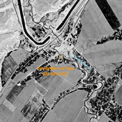
Bandykhansaj Tepe (Uz-SD-281) (5 km)
Late Iron Age settlement, on the right bank of the Bandykhansaj. Small site, studied by Rtveladze. Destroyed by modern urbanisation and cultivation, but possibly identified on Corona imagery.
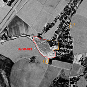
Anonymous settlement (Uz-SD-029) (5 km)
Early, High Medieval and post-Mongol city-size settlement (50 ha). Mostly destroyed in Dzhelair modern town urbanisation. Studied by Arshavskaja and Rtveladze.
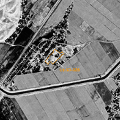
Unidentified site (6 km)
Probable archaeological site. Located with satellite imagery.