
Vici.org

Omgeving:

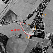
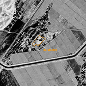
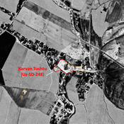
UZB-SD_1970_AS 029 (Jaloyir)UZB-SD_1970_AS 028 (Kumkurgan)UZB-SD_1970_Karvan Tushtu 248

Locatie:

  • Oezbekistan, Taktugay
  • geo:37.784191,67.551231
  • Locatie precies

Period or year:

  • -12xx? / -3xx?

Classificatie:

  • Landelijke nederzetting
  • Niet zichtbaar

Identifiers:

  • vici:place=97184

Annotaties

Er zijn nog geen Nederlandstalige annotaties. Hier volgen annotaties in het Engels.

STRIDE, S. (2004), La Géographie archéologique de la province du Surkhan Darya (Bactriane du Nord, Ouzbekistan du Sud). Unpublished dissertation at the Université panthéon-Sorbonne (Paris), 5 vols. ( https://sirisacademic.academia.edu/SebastianStride?swp=tc-au-44230952 )

STRIDE, S. (2004), La Géographie archéologique de la province du Surkhan Darya (Bactriane du Nord, Ouzbekistan du Sud). Unpublished dissertation at the Université panthéon-Sorbonne (Paris), 5 vols. ( https://sirisacademic.academia.edu/SebastianStride?swp=tc-au-44230952 )


In de buurt

Anonymous settlement (Uz-SD-029) (2 km)

Early, High Medieval and post-Mongol city-size settlement (50 ha). Mostly destroyed in Dzhelair modern town urbanisation. Studied by Arshavskaja and Rtveladze.

Anonymous settlement (Uz-SD-028) (3 km)

Late Medieval settlement (3,75 ha), possibly older. Mostly rectangular site, destroyed and covered by modern housing, but visible on Corona imagery. Studied by Arshavskaja & Rtveladze.

Unidentified site (5 km)

Probable archaeological site. Small mostly square mound, located with satellite imagery.


Dit object is toegevoegd door Julien De Chocqueuse op 2024-06-27. Laatst bewerkt door Julien De Chocqueuse op 2024-07-11. Persistent URI: http://vici.org/vici/97184 . Download als RDF/XML, KML.
Annotatie beschikbaar onder de Creative Commons Naamsvermelding-GelijkDelen 3.0 Unported-licentie. Metadata beschikbaar onder de Creative Commons Publiek Domein Verklaring, tenzij expliciet anders aangegeven.

Vici.org partners:

Livius.org: articles on ancient history   Rijksmuseum van Oudheden