
Er zijn nog geen Nederlandstalige annotaties. Hier volgen annotaties in het Engels.

Omgeving:

Locatie:
- Verenigd Koninkrijk, Dunster
- geo:51.174168,-3.453889
- Locatie precies
Classificatie:
- Fort
- Zichtbaar
Identifiers:
- vici:place=35777
- wikidata:entity=Q4920313
Annotaties
In de buurt
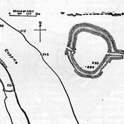
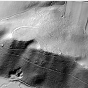
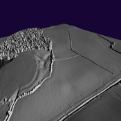
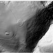
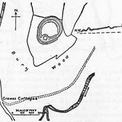
Bats Castle
Iron Age hill fort. Bat's Castle
Grabbist Hill (1 km)
Hillfort on Grabbist Hill
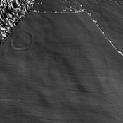
Round earthworks. (3 km)
Round earthworks.