
Il n'y a pas une annotation en français. Présenté est une annotation en Anglais.

Les environs:

Localisation:
- Royaume-Uni, Dunster
- geo:51.174168,-3.453889
- Précision ± 0-5 m.
Classification:
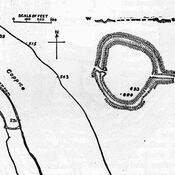
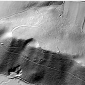
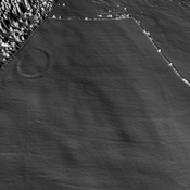
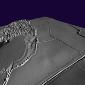
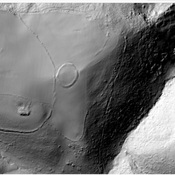
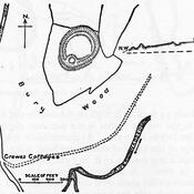
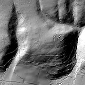
- Camp fortifié
- Visible
Identificateurs:
- vici:place=35777
- wikidata:entity=Q4920313
Annotations
À proximité
Bats Castle
Iron Age hill fort. Bat's Castle
Grabbist Hill (1 km)
Hillfort on Grabbist Hill
Round earthworks. (3 km)
Round earthworks.