
Il n'y a pas une annotation en français. Présenté est une annotation en Anglais.

Les environs:

Localisation:
- Israël, Motsa ‘Illit
- geo:31.791576,35.163116
- Précision exacte
Period or year:
- -7000 / unknown
Classification:
- Ville
- Visible
Identificateurs:
- vici:place=61663
Annotations
Musées associés
Archeologisch museum van Amman
Het oude archeologische museum van Jordanië.
À proximité
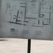
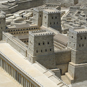
Tel Motza temple
Kingdom of Judah period temple.
Castel (1 km)
A hilltop stronghold protecting the road to Jerusalem, constructed over the ruins of Roman and Crusader forts
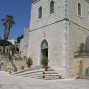
Ein Karem, Crusaders church (2 km)
Under the modern Church of St. John the Baptist are remains of the monastery dedicated to St. Sabas.