

Il n'y a pas une annotation en français. Présenté est une annotation en Anglais.
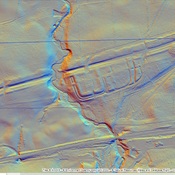
Millitary Way
Built 142-154
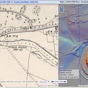
The Military Way was the road running behind the wall that connected all of the forts. It has been identified in several places and marked on the British Ordnance Survey Maps. This is one of these segments