
Er zijn nog geen annotaties toegevoegd. Voeg een annotatie met betrekking tot deze plaats toe.
Er zijn nog geen afbeeldingen met betrekking tot deze plaats toegevoegd.
Afbeelding toevoegen.
Afbeelding toevoegen.
Omgeving:


Locatie:
- Oezbekistan, Oqlar
- geo:38.354897,67.836174
- Locatie precies
Classificatie:
- Archeologische waarneming
- Niet zichtbaar
Identifiers:
- vici:place=97433
Annotaties
In de buurt
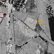
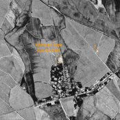
Unidentified site
Probable settlement. Located with satellite imagery.
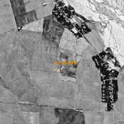
Kosh Tepe 1 (Uz-SD-495) (1 km)
Yuezhi, Kushan, and early Medieval settlement (1 ha). Consisted of a citadal and a lower town, visible on Corona imagery (1970) with indistinct limits. Since destroyed entirely by modern cultivation. Fieldwork by Rtveladze, and surveyed by MAFOuz.
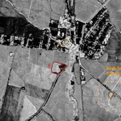
Unidentified site (1 km)
Probable archaeological site. Small mound, visible on Corona imagery (1970), since destroyed by modern cultivation.