
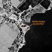
No annotations have been added. Please add information about this place.
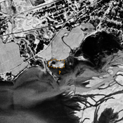
 Corona imagery (1970) - UZB-SD_1970_US-D (Savurtepa 1)")
Surroundings:


Location:
- Uzbekistan, Savurtepa
- geo:37.960789,67.726913
- Location ± 0-5 m.
Class:
- Archaeological observation
- visible
Identifiers:
- vici:place=96785
Annotations
Nearby
Kosha Shait Tepe (Uz-SD-203) (2 km)
Post-Mongol settlement (0,6 ha). Square tepe, used as a cemetery, studied by Arshavskaja & Rtveladze.
Dul'ta Tepe 2 (Uz-SD-359) (2 km)
Early Medieval, pre-Mongol and post-Mongol settlement (0,8 ha). Rectangular site, destroyed by moder, urbanisation. Studied by Arshavskaja & Rtveladze.
Unidentified site (3 km)
Probable archaeological site. Mound visible on Corona imagery (1970), since destroyed by erosion from the reservoir.