
STRIDE, S. (2004), La Géographie archéologique de la province du Surkhan Darya (Bactriane du Nord, Ouzbekistan du Sud). Unpublished dissertation at the Université panthéon-Sorbonne (Paris), 5 vols. ( https://sirisacademic.academia.edu/SebastianStride?swp=tc-au-44230952 )
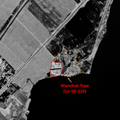
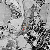
 Corona imagery (1970) - UZB-SD_1970_Shakhri-Gul'gul (Uz-SD-276)")
Surroundings:


Location:
- Uzbekistan, Munchoqtepa
- geo:37.914406,67.678444
- Location ± 0-5 m.
Period or year:
- 10~ / 14xx~
Class:
- Rural settlement
- invisible
Identifiers:
- vici:place=97181
Annotations
Nearby
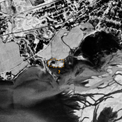
Jakhshibaj Tepe (Uz-SD-219) (2 km)
Kushan and early Medieval settlement. Badly damaged by modern reservoir. Fieldwork by Al'baum (1962) and Nil'sen (1966).
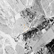
Karaul Tepe (?) (Uz-SD-197) (2 km)
Rectangular tepe. Uncertain identification with site B056 by Rtvladze (14 ha), a Kushan town that could mark the southern border of Chaghanian province.
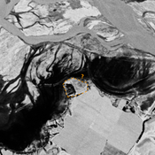
Munchak Tepe (Uz-SD-210) (2 km)
Pre-Mongol (?) settlement (3 ha). Undescribed and mostly destroyed by the Surkhan Darya dam. Uncertain identification with site n°210 by Arshavskaja & Rtveladze.