


Es gibt noch keine Anmerkungen. Bitte, Informationen einfügen.

Lage:
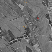
- Usbekistan, Tolli
- geo:38.141445,67.862617
- Lage ± 0-5 m.
Klassification:
- Beobachtung
- Sichtbar
Identifiers:
- vici:place=96571
Anmerkungen
In der Nähe
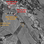
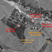
Shor Tepe (Uz-SD-605)
Pre-modern site (0,35), badly damaged. Studied by MAFOuz.
Anonymous settlement (Uz-SD-606) (1 km)
Pre-modern settlement, but possibly older. Mostly rectangular site (0,3 ha), indicated on 1951 topographical map, whose eastern part is almost destroyed by modern cultivation since the 1960's. Surveyed and dated by MAFOuz.
Unidentified site (1 km)
Probable settlement. Located with satellite imagery.