
Es gibt noch keine deutschsprachige Anmerkungen. Präsentiert wirden Anmerkungen auf English.

Umgebung:

Lage:
- Vereinigtes Königreich, Dunster
- geo:51.183403,-3.458129
- Lage ± 0-5 m.
Period or year:
- -1xxx? / unknown
Klassification:
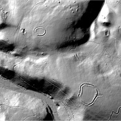
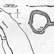
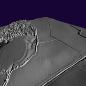
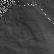
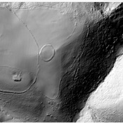
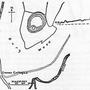
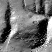
- Kastell
- Sichtbar
Identifiers:
- vici:place=91920
Anmerkungen
In der Nähe
Black Ball Camp (1 km)
Iron Age hill fort
Bats Castle (1 km)
Iron Age hill fort. Bat's Castle
Iron Age Settlement (4 km)
Iron Age Settlement