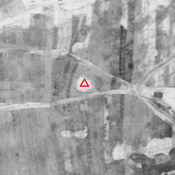
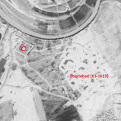
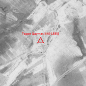
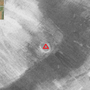
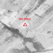
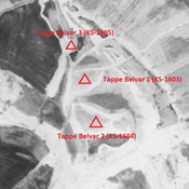
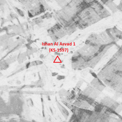
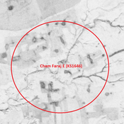
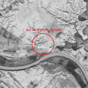
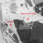
Vici.org

Omgeving:

Unidentified site (Razūqī 1) - CORONA imagery 1968Unidentified site (Razūqī 2) - CORONA imagery 1968Unidentified site (Mankhūsh 1) - CORONA imagery 1968Tappe Qaymasi (KS-1585) - CORONA imagery 1968Unidentified site (Bunneh Farwaz Khān 1)Anonymous settlement (KS-1601) - CORONA imagery 1968Tappe Belvar 2 (KS-1604) - CORONA imagery 1968Ishan Al Asvad 1 (KS-1597) - CORONA imageryCham Faraj E (KS1646) - CORONA imagery 1968Nur Ali (KS1629, KS1640) - CORONA imagery 1968Tappe Faraj (KS-1602) - CORONA imagery 1968

Locatie:

  • Iran, Ḩājjī Naşrollāh
  • geo:31.870487,48.981342
  • Locatie precies

Period or year:

  • 6xx / 14xx

Classificatie:

  • Vicus of canabae
  • Zichtbaar

Identifiers:

  • vici:place=85887

Annotaties

MOGHADDAM Abbas & MIRI Negin (2003), Archaeological Research in the Mianab Plain of Lowland Susiana, South-Western Iran, Journal of the British Institute of Persian Studies (https://www.researchgate.net/publication/262117290_Archaeological_Research_in_the_Mianab_Plain_of_Lowland_Susiana_South-Western_Iran)


In de buurt

Anonymous settlement (KS-1611)

Middle Islamic settlement (2,03 ha). Almost completely destroyed by agriculture.

Tappe Hamyan (KS-1608)

Parthian and early medieval Islamic settlement. (3,05 ha). Destroyed by agriculture.

Tall-e Deymi (KS-1609) (1 km)

Early and middle Islamic site (0,73 ha).


Dit object is toegevoegd door Julien De Chocqueuse op 2023-04-16. Laatst bewerkt door Julien De Chocqueuse op 2023-04-18. Persistent URI: http://vici.org/vici/85887 . Download als RDF/XML, KML.
Annotatie beschikbaar onder de Creative Commons Naamsvermelding-GelijkDelen 3.0 Unported-licentie. Metadata beschikbaar onder de Creative Commons Publiek Domein Verklaring, tenzij expliciet anders aangegeven.

Vici.org partners:

Livius.org: articles on ancient history   Rijksmuseum van Oudheden