


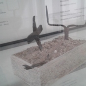
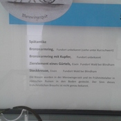
No annotations have been added. Please add information about this place.

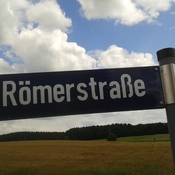
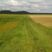
Location:
- Germany, Valley
- geo:47.885471,11.79079
- Location ± 0-5 m.
Class:
- Rural settlement
- invisible
Identifiers:
- vici:place=52666
Annotations
Nearby
Oppidum Fentbachschanze
Oppidum Fentbachschanze
Siedlung Maxlmühle
Siedlung
Siedlung Weyarmer Mühle (1 km)
Siedlung