Il n'y a pas une annotation en français. Présenté est une annotation en Anglais.
GAUBE Heinz (1973), Die sudpersische Provinz Arragan - Kuh-Giluyeh von der arabischen Eroberung bis zur Safawidenzeit




GAUBE Heinz (1973), Die sudpersische Provinz Arragan - Kuh-Giluyeh von der arabischen Eroberung bis zur Safawidenzeit
GAUBE Heinz (1973), Die sudpersische Provinz Arragan - Kuh-Giluyeh von der arabischen Eroberung bis zur Safawidenzeit
Probable archaeological site. Small mound, in the area of Meymand larger site, visible on Corona (1969) and KH9-Hexagon (1984) imagery. Since destroyed.
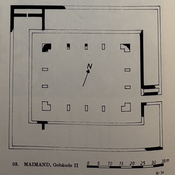
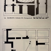
Probable archaeological site, immediately south of Kushk-e Dashtak-e Meymand. Mostly squared ruined fortified structure (30x40). Located withsatellite imagery.
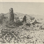
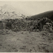
Medieval Islamic housing squared ruined building, in the larger site of Meymand. Surveyed by Gaube (1968) (building I).