
Il n'y a pas une annotation en français. Présenté est une annotation en Anglais.

Localisation:
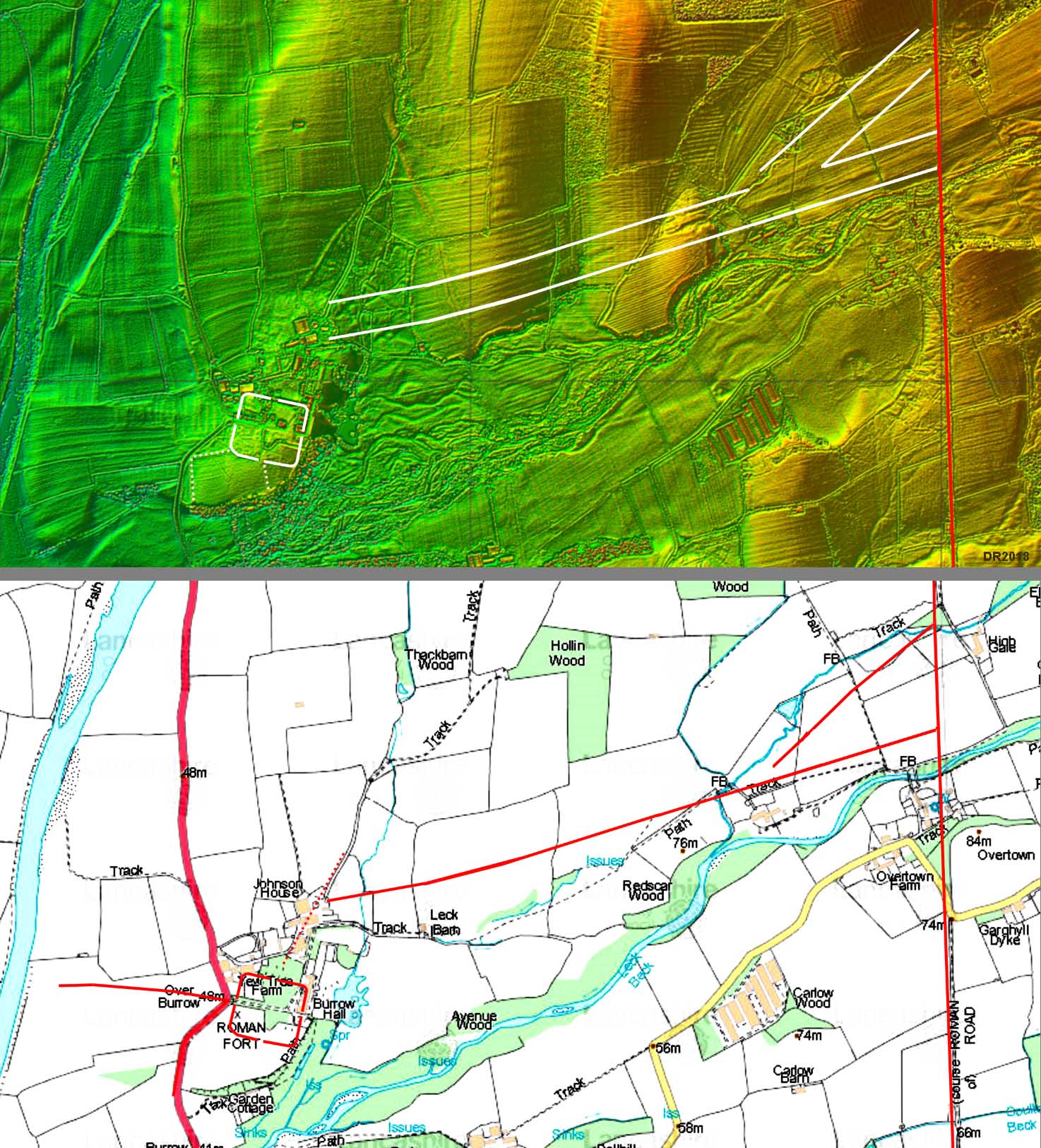
- Royaume-Uni, Nether Burrow
- geo:54.179676,-2.585747
- Précision ± 0-5 m.
Period or year:
- 150 / unknown
Classification:
- Voie romaine
- Visible
Identificateurs:
- vici:place=57347
Annotations
À proximité
Galacum Fort
Galacum Fort
Galacum
OmnesViae import OVPlace455
Bindloss Farm (2 km)
Prehistoric, Romano-British, medieval and early post-medieval settlements, field systems and a deer park at High Park, east of Bindloss Farm.