
Il n'y a pas d'annotations. Ajouter une note.

Localisation:
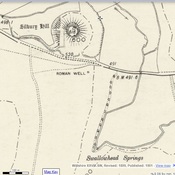
- Royaume-Uni, Honeystreet
- geo:51.353573,-1.845233
- Précision ± 0-5 m.
Period or year:
- 1xx? / unknown
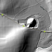
Classification:
- Voie romaine
- Invisible
Identificateurs:
- vici:place=98496
Annotations
À proximité
Icknield Way (1 km)
Roman Rd.
Adam's Grave, Alton Barnes (1 km)
Neolithic long barrow near Alton Barnes in Wiltshire
Knap Hill (2 km)
BA Settlement.