

No annotations have been added. Please add information about this place.

Location:
- Uzbekistan, Ir-Sake
- geo:38.421097,67.89653
- Location ± 0-5 m.
Class:
- Archaeological observation
- invisible
Identifiers:
- vici:place=97431
Annotations
Nearby
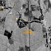
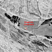
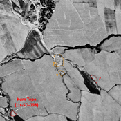
Kul' Tepe (Uz-SD-481) (1 km)
Pre-Mongol Medieval Islamic settlement. Small mound (0,15 ha), visible on Corona imagery (1970), since destroyed bu urbanisation. Surveyed by MAFOuz.
Unidentified site (2 km)
Probable settlement. Located with satellite imagery.
Unidentified site (3 km)
Possible archaeological site. Used today as a cemetery. Located with satellite imagery.