


STRIDE, S. (2004), La Géographie archéologique de la province du Surkhan Darya (Bactriane du Nord, Ouzbekistan du Sud). Unpublished dissertation at the Université panthéon-Sorbonne (Paris), 5 vols. ( https://sirisacademic.academia.edu/SebastianStride?swp=tc-au-44230952 )

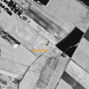
Location:
- Uzbekistan, Denov
- geo:38.274578,67.886543
- Location ± 0-5 m.
Period or year:
- 10~ / 3xx
Class:
- Rural settlement
- visible
Identifiers:
- vici:place=96867
Annotations
Nearby
Bekovkij Kala (Uz-SD-374)
Late Bronze Age (?), Kushan, early Medieval (?) and pre-modern circular fortress (2 ha), partially destroyed in 1970 during a flood of the Kyzylsu. Studied by Pugachenkova and Rtveladze. Uncertainties about the datation.
Seid Atalyk medersa (Uz-SD-610)
XVIe c. medersa. Studied and described by Pagachenkova and Rtveladze.
Kallja Minor (Uz-SD-286)
Also known as Munar Tepe. Kushan settlement (0,3 ha). High mound, built upon and partially destroyed, but presumably much larger settlement a long time ago. Studied by Rtveladze.