
STRIDE, S. (2004), La Géographie archéologique de la province du Surkhan Darya (Bactriane du Nord, Ouzbekistan du Sud). Unpublished dissertation at the Université panthéon-Sorbonne (Paris), 5 vols. ( https://sirisacademic.academia.edu/SebastianStride?swp=tc-au-44230952 )
")
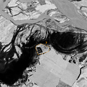
Location:
- Uzbekistan, Chayan
- geo:37.863403,67.68911
- Location ± 0-5 m.
Period or year:
- 7xx? / 12xx?
Class:
- Building (other)
- invisible
Identifiers:
- vici:place=96779
Annotations
Nearby
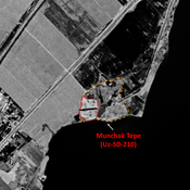
Munchak Tepe (Uz-SD-210) (4 km)
Pre-Mongol (?) settlement (3 ha). Undescribed and mostly destroyed by the Surkhan Darya dam. Uncertain identification with site n°210 by Arshavskaja & Rtveladze.
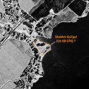
Jakhshibaj Tepe (Uz-SD-219) (4 km)
Kushan and early Medieval settlement. Badly damaged by modern reservoir. Fieldwork by Al'baum (1962) and Nil'sen (1966).
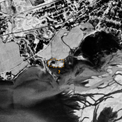
Unidentified site (4 km)
Probable archaeological site, badly damaged by dam reservoir. Located with satellite imagery.