
STRIDE, S. (2004), La Géographie archéologique de la province du Surkhan Darya (Bactriane du Nord, Ouzbekistan du Sud). Unpublished dissertation at the Université panthéon-Sorbonne (Paris), 5 vols. ( https://sirisacademic.academia.edu/SebastianStride?swp=tc-au-44230952 )

Location:
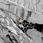
- Uzbekistan, Yangihayot
- geo:38.438549,67.934883
- Location ± 0-5 m.
Period or year:
- 4xx / 12xx
Class:
- Rural settlement
- visible
Identifiers:
- vici:place=96578
Annotations
Nearby
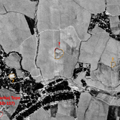
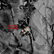
Unidentified site
Probable archaeological site. Small square mound, visible on Corona imagery (1970), since destroyed by urbanisation.
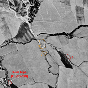
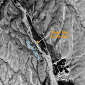
Dauletbaj Tepe (Uz-SD-093)
Medieval site. Studied by Arshavskaja & Rtveladze but undescribed. Small mound visible on Corona imagery.
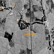
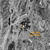
Unidentified site (1 km)
Probable archaeological site. Medium mound, visible on Corona imagery (1970) ; eastern and southern parts destroyed by modern cultivation.