
Il n'y a pas une annotation en français. Présenté est une annotation en Anglais.

Les environs:
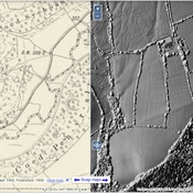


Localisation:
- Royaume-Uni, Dinas
- geo:52.005985,-4.908475
- Précision ± 0-5 m.
Period or year:
- 8xx? / unknown
Classification:
- Camp fortifié
- Visible
Identificateurs:
- vici:place=96308
Annotations
À proximité
Iron Age Settlement (5 km)
Iron Age Settlement
Roman Rd (6 km)
Roman Rd
Iron Age Settlement (8 km)
Iron Age Settlement