
Es gibt noch keine deutschsprachige Anmerkungen. Präsentiert wirden Anmerkungen auf English.

Umgebung:
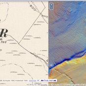
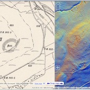

Lage:
- Vereinigtes Königreich, Davington
- geo:55.289829,-3.192357
- Lage ± 0-5 m.
Period or year:
- -4xx / unknown
Klassification:
- Bäuerliche Siedlung
- Sichtbar
Identifiers:
- vici:place=95167
Anmerkungen
In der Nähe
Raeburnfoot Temporary Camp
Raeburnfoot Temporary Camp
Group of Tumli (1 km)
Group of Tumli
Iron Age Settlement (1 km)
Iron Age Settlement