
Es gibt noch keine Anmerkungen. Bitte, Informationen einfügen.

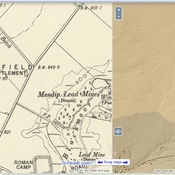
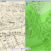
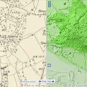
Lage:
- Vereinigtes Königreich, Tynings Farm
- geo:51.308525,-2.772439
- Lage ± 0-5 m.
Period or year:
- 7x / unknown
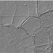
Klassification:
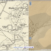
- Römerstraße
- Sichtbar
Identifiers:
- vici:place=95014
Anmerkungen
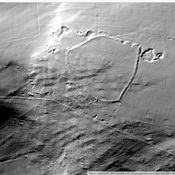
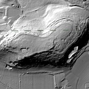
In der Nähe
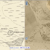
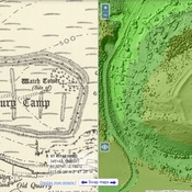
Roman camp
Roman camp
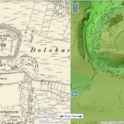
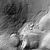
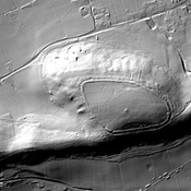
Dolebury Warren (2 km)
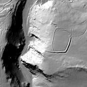
Watchtower
Dolebury Camp (2 km)
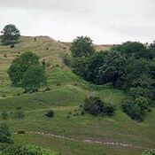
Dolebury Warren - Iron Age fort