Vici.org

Les environs:

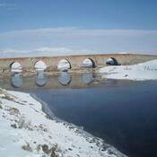
Ҫobandede Koprusu

Localisation:

  • Turquie, Ömertepe
  • geo:39.907383,41.130836
  • Précision ± 0-5 m.

Period or year:

  • -4000~ / unknown

Classification:

  • Habitat rural
  • Visible

Identificateurs:

  • vici:place=93496

Annotations

During the excavation, four building levels dating back to the 4th millennium BC and the Chalcolithic Age were identified at the During the mound excavation, four building levels dating back to the 4th millennium BC and the Chalcolithic Age were identified.

Sources:

  1. https://www.aa.com.tr/tr/kultur-sanat/pulur-hoyuk-kazilarinda-neolitik-ve-kalkolitik-donemlere-ait-izlere-rastlandi/2370992

À proximité

Calcidava (4 km)

OmnesViae import TPPlace2481

Ҫobandede Koprusu (6 km)

Roman Bridge

Roman Rd (7 km)

Roman Rd