
Vici.org
No images available yet. Please add images related to this place.

Surroundings:

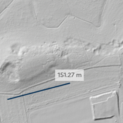
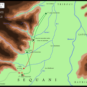
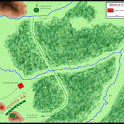
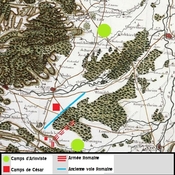
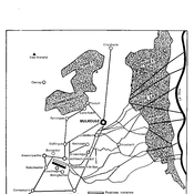
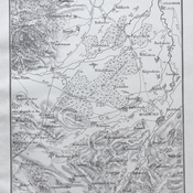
Horouderenhubel LIDARCampagne_Alsace_-581024px-Bataille_Ochsenfeld_-58cassLocalisation possible, selon H. ChristPlan des schlachtfeldes im kriege gegen ariovistPlan des schlachtfeldes im kriege gegen ariovistDiverse bebouwingsporen ten oosten van Villa SchimmelrainIllzach

Location:

  • France, Cité Grassegert
  • geo:47.79105,7.240038
  • Location ± 0-5 m.

Period or year:

  • 100 / unknown

Class:

  • Relief, votiv stone or altar
  • invisible

Identifiers:

  • vici:place=92520

Annotations

There is no English annotation yet. Presented is an annotation in French.

Wittelsheim Langhurst, stèle funéraire

Wittelsheim Langhurst, stèle funéraire


Nearby

Wittelsheim Carreau Amélie 1, bassin octogonal

Wittelsheim Carreau Amélie 1, bassin octogonal

Wittelsheim Amélie 1b, Mur, fosse, meule antique

Wittelsheim Amélie 1b, Mur, fosse, meule antique

Aspach-le-Haut bataille de l'Ochsenfeld (- 58 av jc) camp secon (1 km)

Aspach-le-Haut bataille de l'Ochsenfeld (- 58 av jc) camp secondaire de Jules César


This object was added by louproma on 2023-12-05. Last update by louproma on 2023-12-05. Persistent URI: http://vici.org/vici/92520 . Download as RDF/XML, KML.
Annotation available using the Creative Commons Attribution-ShareAlike 3.0 Unported license. Metadata available using the Creative Commons Public Domain Dedication, unless it is explicitly stated otherwise.

Vici.org partners:

Livius.org: articles on ancient history   Rijksmuseum van Oudheden