

Il n'y a pas d'annotations. Ajouter une note.

Localisation:
- Iran, ‘Abdolī
- geo:31.790348,48.824051
- Précision ± 0-5 m.
Classification:
- Observation
- Visible
Identificateurs:
- vici:place=86480
Annotations
À proximité
Unidentified site (2 km)
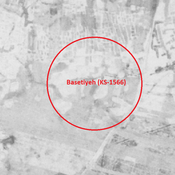
Probable settlement (cluster of mounds). Located with satellite imagery.
Unidentified site (3 km)
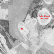
Probable ancient mound, recently urbanized. Better visible on CORONA imagery.
Unidentified site (3 km)
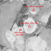
Probable settlement. Located with satellite imagery.