
Il n'y a pas d'annotations. Ajouter une note.
 - CORONA imagery 1")
Les environs:


Localisation:
- Iran, Gobeyr
- geo:31.871614,48.860306
- Précision ± 0-5 m.
Classification:
- Observation
- Visible
Identificateurs:
- vici:place=85925
Annotations
À proximité
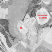
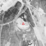
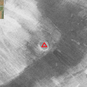
Unidentified site
Probable settlement. Located with satellite imagery.
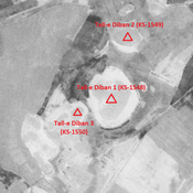
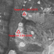
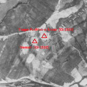
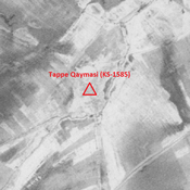
Tappe-e Haji Mohammad (KS-1594) (1 km)
Achaemenid, Parthian, Sasanian and middle Islamic settlement (0,53 ha).
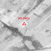
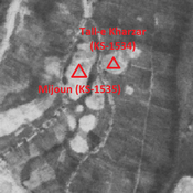
Unidentified site (2 km)
Probable settlement. Located with satellite imagery.