


STRIDE, S. (2004), La Géographie archéologique de la province du Surkhan Darya (Bactriane du Nord, Ouzbekistan du Sud). Unpublished dissertation at the Université panthéon-Sorbonne (Paris), 5 vols. ( https://sirisacademic.academia.edu/SebastianStride?swp=tc-au-44230952 )

Location:
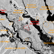
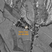
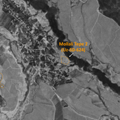
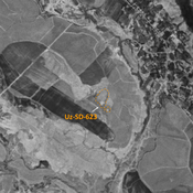
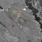
- Uzbekistan, Baxtlitepa
- geo:38.050213,67.7789
- Location ± 0-5 m.
Period or year:
- 10~ / 12xx~
Class:
- Rural settlement
- visible
Identifiers:
- vici:place=78497
Annotations
Nearby
Unidentified site (1 km)
Probable archaeological site. Small citadel and lower town visible on Corona imagery, since covered and partially destroyed by modern construction.
Unidentified site (2 km)
Probable archaeological site. Small mound, part of a formally larger urban area, visible on Corona imagery.
Unidentified site (2 km)
Probable archaeological site. Remaining mound of a formally larger site, which extended in all directions, with indistinct limits visible on Corona imagery (1970).