Vici.org
Il n'y a pas d'images. Télécharger une image.

Les environs:

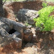
Mycenaean Tomb

Localisation:

  • Grèce, Ligariá
  • geo:38.940182,22.3717
  • Précision ± 0-5 m.

Period or year:

  • 1xx / unknown

Classification:

  • Village
  • Visible

Identificateurs:

  • vici:place=78290

Annotations

Il n'y a pas une annotation en français. Présenté est une annotation en Anglais.

Side is identidied with the site near Lygaria (prev. Tsopalades). It is recorded in a boundary inscription of the Hadrianic period. Side (ancient Greek: Σίδη) was a settlement and fortress of the Ainians in ancient Thessaly.

See:

  1. Richard Talbert, ed. Barrington Atlas of the Greek and Roman World. Princeton University Press 2000, p. 55
  2. Mogens Herman Hansen & Thomas Heine Nielsen , "Thessaly and Adjacent Regions". An inventory of archaic and classical poleis. New York: Oxford University Press, 2004 p. 684
À proximité

Roman Fort

Roman Fort

Battle of Spercheios (4 km)

The Battle of Spercheios took place in 997 AD. It was fought between a Bulgarian army led by Tsar Samuil, which in the previous year had penetrated south into Greece, and a Byzantine army under the command of general Nikephoros Ouranos

Castle of Lamia (6 km)

Castle of Lamia