
Vici.org

Les environs:

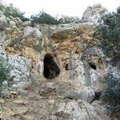
Tel Hreiz, seawallFinger Cave. Mount Carmel

Localisation:

  • Israël, HaH̱oterim
  • geo:32.745834,34.947498
  • Précision ± 0-5 m.

Period or year:

  • -7000~ / -5000~

Classification:

  • Habitat rural
  • Visible

Identificateurs:

  • vici:place=63377

Annotations

Il n'y a pas une annotation en français. Présenté est une annotation en Anglais.

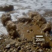
Tel Hreiz is was a Neolithic fishing village supported by the seewalls. Thw walls made of  of large, rounded boulders of aeolianite and limestone, which were transported from Oren or Galim Rivers.

See:

  1. Akdeniz’de 7.000 Yıllık Deniz Duvarı Bulundu-https://arkeofili.com/akdenizde-7-000-yillik-deniz-duvari-bulundu/
  2. https://www.timesofisrael.com/scientists-find-9000-year-old-seawall-built-to-stave-off-rising-sea-levels/

Tel Hreiz is was a Neolithic fishing village supported by the seewalls. Thw walls made of  of large, rounded boulders of aeolianite and limestone, which were transported from Oren or Galim Rivers.

See:

  1. Akdeniz’de 7.000 Yıllık Deniz Duvarı Bulundu-https://arkeofili.com/akdenizde-7-000-yillik-deniz-duvari-bulundu/
  2. https://www.timesofisrael.com/scientists-find-9000-year-old-seawall-built-to-stave-off-rising-sea-levels/

À proximité

Tel Hreiz

Submerged Neolithic seawall in Tel Hreiz.

Megadim shipwreck (1 km)

Hellenistic shipwreck.

Atlit Yam (3 km)

Submerged settlements and shipwrecks.