Vici.org

Omgeving:

Carassura Basilica

Locatie:

  • Bulgarije, Chirpan
  • geo:42.240726,25.385572
  • Locatie precies

Period or year:

  • ante 100~ / unknown

Classificatie:

  • Fort
  • Zichtbaar

Identifiers:

Annotaties

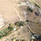
Een laat-Romeins statio militaris dat zich later tot een vesting ontwikkelde. Karasura lag aan de weg (Via Militaris) die in de oudheid de kortste verbinding vormde tussen Europe aan het midden-Oosten1.

Bronverwijzingen

  1. Wikipedia: Karasura

The fortress of Karasoura was located on a Roman road northeast of modern Chirpan. It is believed that at a certain point the name of the site was changed to Diospolis and, subsequently, to Blisnos (before the 11th century).

Kamen Stanev, “Kăde e bil srednovekovnijat grad Vlisnos (Blisnos, Blizmos)?” Minalo 4/2010: 19–27.

http://mobile-history.eu/objectoverview.php?land=Bulgaria,1842&state=Stara%20Zagora%20(%D0%A1%D1%82%D0%B0%D1%80%D0%B0%20%D0%97%D0%B0%D0%B3%D0%BE%D1%80%D0%B0),1873&county=Chirpan%20(%D0%A7%D0%B8%D1%80%D0%BF%D0%B0%D0%BD),1961&poi=Roman%20Fortress%20Karasura,47129


In de buurt

Basilica II

Basilica II

Station

Station

Bazilica

Bazilica


Dit object is toegevoegd door René Voorburg op 2012-05-29. Laatst bewerkt door Ian Mladjov op 2026-03-29. Persistent URI: http://vici.org/vici/6246 . Download als RDF/XML, KML.
Annotatie beschikbaar onder de Creative Commons Naamsvermelding-GelijkDelen 3.0 Unported-licentie. Metadata beschikbaar onder de Creative Commons Publiek Domein Verklaring, tenzij expliciet anders aangegeven.
Lijntracé bij dit punt door Ludwinski.

Vici.org partners:

Livius.org: articles on ancient history   Rijksmuseum van Oudheden