Vici.org

Surroundings:

GebäudeStadtmauerGrabsteinBasel, 374 AD: View of the fortified settlement on the cathedral hill, the settlement in the Birsigtal and the right bank of the small fortress (Munimentum).Romischwe keller in Antikenmuseum BaselLate roman burgus on Rhine river in 374 AD.WehrturmCeltic fortified settlement in 80 BCinfographic panel of murus galicus from Bselmurus gallicus near rittergassereconstruction of murus gallicus from BaselTemple of Pfaffenlohweg, RiehenSchautafelWohngebäude

Location:

  • Switzerland, Basel
  • geo:47.55677,7.59112
  • Location ± 0-5 m.

Period or year:

  • 300 / unknown

Class:

  • Building (other)
  • visible

Identifiers:

  • vici:place=61262

Annotations

Description:
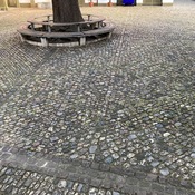
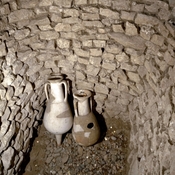
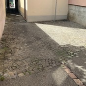
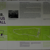
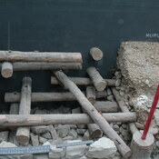
In the vicinity of the building Münsterplatz 18 stood around 300 AD, a Sodbrunnen. Today, a circular cast-iron plate marks its former location in the paving. The Sodbrunnen reached down to a water-bearing layer at a depth of 20 meters. From this, the fountain was continuously fed with new water. After the excavation he was backfilled for security reasons.

finding:
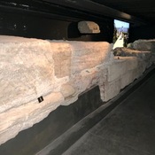
The Sodbrunnen was discovered in 1944 and excavated.

Source: https://www.archaeologie.bs.ch/vermitteln/info-stellen/muensterplatz.html


Nearby

Gebäude

Gebäude – Basilia – Basel – BS – Schweiz

Spätrömische Kastell Basel

Late roman fortified settlement build around 270/280 A.D.

Antikenmuseum Basel

Antikenmuseum


This object was added by Werner Doenni on 2019-04-13. Last update by simon on 2019-07-05. Persistent URI: http://vici.org/vici/61262 . Download as RDF/XML, GeoJSON, KML.
Annotation available using the Creative Commons Attribution-ShareAlike 3.0 Unported license. Metadata available using the Creative Commons Public Domain Dedication, unless it is explicitly stated otherwise.

Vici.org partners:

Livius.org: articles on ancient history   Rijksmuseum van Oudheden