
Es gibt noch keine deutschsprachige Anmerkungen. Präsentiert wirden Anmerkungen auf English.

Lage:
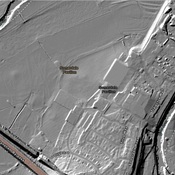
- Vereinigtes Königreich, Upper Stanton Drew
- geo:51.367825,-2.574667
- Genaue Lage
Period or year:
- -3000~ / -2000~
Klassification:
- Weihaltar, Votivstein oder Relief
- Sichtbar
Identifiers:
- vici:place=60517
Anmerkungen
In der Nähe
Stanton Drew Great Circle
Stanton Drew stone circles.
Stanton Drew Southwest Circle
Stanton Drew stone circles.
Stanton Drew Great Cove
Neolithic standing stones.