Vici.org

Les environs:

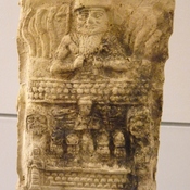
Gilgamesh tablet

Localisation:

  • Irak, Tarkalān
  • geo:35.370506,44.254669
  • Précision ± 25-100 m.

Period or year:

  • -2350~ / unknown

Classification:

  • Autel ou sculpture
  • Visible

Identificateurs:

  • vici:place=57560

Annotations

Il n'y a pas une annotation en français. Présenté est une annotation en Anglais.

Nuzi Map isa map of preflood Near East, dates to the Old Akkadian period (ca. 2360-2180 BC). Its depicts the neibourhood of Gasur. Currently housed in The Semitic Museum at Harvard.

See:

  1. Wayne Horowitz: Mesopotamian Cosmic Geography, Eisenbraun 1998, pp. dif.
  2. Richard J. A. Talbert: Ancient Perspectives: Maps and Their Place in Mesopotamia, Egypt, Greece, and Rome, University of Chicago Press 2014
  3. Eleanor Robson, Mathematics in the Ancient Iraq: A Social History, Princeton University Press, 2008
À proximité

Gasur, Temple of Istar-Sawuska

Gasur [Nuzi] - Yorghan Tepe. Old Babylonian Period temple probably dedicated to Istar-Sawuska,

Gasur [Nuzi] - Jurghan Tabba

Known also as Nuzu. Founded during the Akkadian Empire and named Gasur. In the middle of the second millennium incoroprated by Hurrians and renemed renamed Nuzi.

Thelser (16 km)

OmnesViae import TPPlace2682