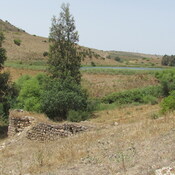
Vici.org
No images available yet. Please add images related to this place.

Surroundings:

Water reservoir and dam.

Location:

  • Israel, Nā‘ūra
  • geo:32.618187,35.379261
  • Location ± 0-5 m.

Class:

  • Rural settlement
  • visible

Identifiers:

  • vici:place=51219

Annotations


Nearby

Tell Agol - Anaharath? (1 km)

Iron Age fortification wall(s) remains.

Naim (3 km)

Roman village

Horbat Tevet (4 km)

Settlement occupied from Middle Bronze till Byzantine.


This object was added by Elżbieta on 2018-04-12. Last update by Elżbieta on 2018-04-12. Persistent URI: http://vici.org/vici/51219 . Download as RDF/XML, KML.
Annotation available using the Creative Commons Attribution-ShareAlike 3.0 Unported license. Metadata available using the Creative Commons Public Domain Dedication, unless it is explicitly stated otherwise.

Vici.org partners:

Livius.org: articles on ancient history   Rijksmuseum van Oudheden