

Il n'y a pas une annotation en français. Présenté est une annotation en Anglais.
See:
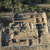
- Yitzhak Paz et all., An early bronze age fertilized agricultural plot discovered near Tel Yarmouth, Ramat Bet Shemesh, Israel, in: Journal of Archaeological Science: Reports, Volume 15, October 2017, pp. 226-234