Vici.org
No images available yet. Please add images related to this place.

Surroundings:

CambridgeRoman villa ?HauxtonWandlebury Ring

Location:

  • United Kingdom of Great Britain and Northern Ireland, Cambridge
  • geo:52.2136,0.113126
  • Location ± 25-100 m.

Class:

  • Rural settlement
  • invisible

Identifiers:

Annotations

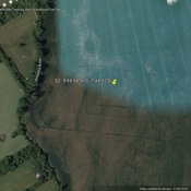
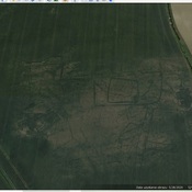
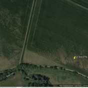
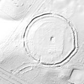
There is some confusion in the name as George Babington, writing in 1883, calls the town Camboritum, and it is shown by that name on the Ordnance Survey Maps.  The better usage is Duroliponte.  Camboritum is at Lackford.  There is inconclusive evidence of  Claudian era ditches at the rear of the Cambridgeshire Archives building.

http://www.pastscape.org.uk/hob.aspx?hob_id=371356

http://www.british-history.ac.uk/rchme/cambs/lix-lxxii ;

 http://roman-britain.co.uk/places/duroliponte.htm ;

http://ebooks.cambridge.org/chapter.jsf?bid=CBO9781107589872&cid=CBO9781107589872A007


Nearby

Cambridge (2 km)

Roman coins found

Nine Wells (5 km)

The source probably had religious significance for Iron Age people and the Romans

Cambridge (5 km)

A Roman farm or villa sits over ditches from Iron Age settlements, and these were all drawn to the site by the presence of Nine Wells, and set of ancient Chalk Springs.


This object was added by René Voorburg on 2012-05-29. Last update by Randal Gilbert on 2016-07-21. Persistent URI: http://vici.org/vici/3861 . Download as RDF/XML, GeoJSON, KML.
Annotation available using the Creative Commons Attribution-ShareAlike 3.0 Unported license. Metadata available using the Creative Commons Public Domain Dedication, unless it is explicitly stated otherwise.
Line tracing by Randal Gilbert.

Vici.org partners:

Livius.org: articles on ancient history   Rijksmuseum van Oudheden