Er zijn nog geen Nederlandstalige annotaties. Hier volgen annotaties in het Engels.
The only classical geographical reference which contains the Roman name for the Water Eaton area is the Antonine Itinerary of the late-second century. In Iter II, "the route from Hadrian's Wall to the port of Rutupiae", the name Pennocrucio is listed 12 miles from Uxacona (Redhill, Shropshire) and 12 miles from Letocetum (Wall, Staffordshire).
The name Pennocrucium is a straight Romanisation of the original Celtic name penn-crug meaning 'the head, or terminus, of the ridge'. This refers to the long ridge of land lying on the eastern bank of the River Penk, upon which the modern town of Penkridge now lies.
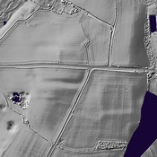
The Roman civil settlement of Pennocrucium was identified from the air in 1946 and confirmed by subsequent excavations, which revealed a rectangular enclosure of 2.8 hectares lying astride Watling Street at Water Eaton, between Gailey and the crossing of the River Penk. Traces of three ditches were found, but no evidence of stone buildings or walls. The interior has evidence of wooden structures fronting onto Watling Street, cobbled streets and rubbish pits. Pottery finds range from late first to late third centuries, with the possibility of two occupation periods, the latest being from the late second century. A causeway through the south side of the defenses marks the entrance of the road from Greensforge.
Pennocrucium is likely the site of a Roman Imperial way station or Mutationes (from Latin mutatio: changing, exchange), where persons on official business could obtain a change of horses before continuing on to the next locus in their itinerary.
See also http://www.pastscape.org.uk/hob.aspx?hob_id=77243
See also https://www.roman-britain.co.uk/places/pennocrucium/
The only classical geographical reference which contains the Roman name for the Water Eaton area is the Antonine Itinerary of the late-second century. In Iter II, "the route from Hadrian's Wall to the port of Rutupiae", the name Pennocrucio is listed 12 miles from Uxacona (Redhill, Shropshire) and 12 miles from Letocetum (Wall, Staffordshire).
The name Pennocrucium is a straight Romanisation of the original Celtic name penn-crug meaning 'the head, or terminus, of the ridge'. This refers to the long ridge of land lying on the eastern bank of the River Penk, upon which the modern town of Penkridge now lies.
The Roman civil settlement of Pennocrucium was identified from the air in 1946 and confirmed by subsequent excavations, which revealed a rectangular enclosure of 2.8 hectares lying astride Watling Street at Water Eaton, between Gailey and the crossing of the River Penk. Traces of three ditches were found, but no evidence of stone buildings or walls. The interior has evidence of wooden structures fronting onto Watling Street, cobbled streets and rubbish pits. Pottery finds range from late first to late third centuries, with the possibility of two occupation periods, the latest being from the late second century. A causeway through the south side of the defenses marks the entrance of the road from Greensforge.
Pennocrucium is likely the site of a Roman Imperial way station or Mutationes (from Latin mutatio: changing, exchange), where persons on official business could obtain a change of horses before continuing on to the next locus in their itinerary.
See also http://www.pastscape.org.uk/hob.aspx?hob_id=77243
See also https://www.roman-britain.co.uk/places/pennocrucium/