

Es gibt noch keine deutschsprachige Anmerkungen. Präsentiert wirden Anmerkungen auf English.
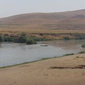
Körtik Tepe was discovered in 1991 during the survey conducted by Algaze in the Ilisu Dam Reservoir survey. The excavations were started in 2000 by the University of Dicle. The excavation yielded the Aceramic Neolithic settlement. The settlement contained at least six different building phases each containing circular planned houses. Burials were intarmural graves.
See:
- Vecihi Özkaya, Aytaç Coşkun, Nevin Soyukaya, Körtik Tepe. Uygarlığın Diyarbakır’daki Ilk Adımları / The first traces of Civilization in Diyarbakir / Die ersten Stufen der Zivilisation in Diyarbakir, Istanbul 2013
- Kortik Tepe-Türkiye Arkeolojik Yerleşmeleri - TAY Projesi.