Il n'y a pas une annotation en français. Présenté est une annotation en Anglais.
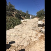
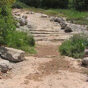
A site on the side of the modern road, which is following a Roman period road between Gaza / Eleuthropolis and Jerusalem. The mile stones attest to the maintanance of the road by the Roman authorities in the third century. Look NE for the site where carved steps of that road were recovered (near Kh. Khanoth.)
http://www.biblewalks.com/Sites/elahvalleyromanRoad.html
A site on the side of the modern road, which is following a Roman period road between Gaza / Eleuthropolis and Jerusalem. The mile stones attest to the maintanance of the road by the Roman authorities in the third century. Look NE for the site where carved steps of that road were recovered (near Kh. Khanoth.)
http://www.biblewalks.com/Sites/elahvalleyromanRoad.html