Vici.org
No images available yet. Please add images related to this place.

Surroundings:

Belvoir Crusader Fortress - remainsBelvoir Crusader Fortress - remainsBelvoir Crusader Fortress - remainsBelvoir Crusader Fortress - remainsPlan of the FortressBelvoir Crusader Fortress - remainsWay to the fortress.Belvoir Crusader Fortress - remainsBelvoir Crusader FortressBelvoir Crusader Fortress - remainsBelvoir Crusader FortressBelvoir Crusader FortressRuins of the fortressRuins of the fortressWater reservoir and dam.

Location:

  • Israel, Nevve Ur
  • geo:32.596226,35.522785
  • Location ± 0-5 m.

Class:

  • Site of historic event
  • visible

Identifiers:

Annotations

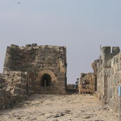
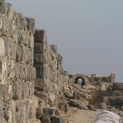
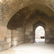
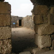
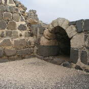
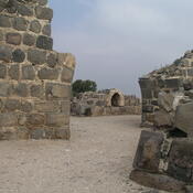
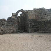
Following Saladin's victory over the Crusaders at the battle of the Horns of Hattin, Belvoir was besieged. The siege lasted a year and a half, until the defenders surrendered on 5 January 1189. 


https://en.wikipedia.org/wiki/Belvoir_Fortress


Nearby

Belvoir Fortress - Kochav HaYarden

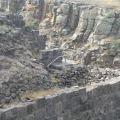
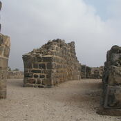
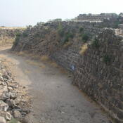
Crusader fortress of the Knights Hospitaller [Order of the Knights of Saint John]

Gesher (3 km)

Early Neolithic and the Middle Bronze Age site.

Milestones (4 km)

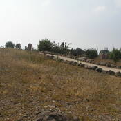
Five to six milestones, probably from the Roman road that led from Scythopolis to Gedara and Tiberias, were found 1 km southeast of Tel Yissakhar, east of the highway and next to a high tension wire.


This object was added by Ludwinski on 2017-01-30. Last update by Ludwinski on 2017-01-30. Persistent URI: http://vici.org/vici/34994 . Download as RDF/XML, GeoJSON, KML.
Annotation available using the Creative Commons Attribution-ShareAlike 3.0 Unported license. Metadata available using the Creative Commons Public Domain Dedication, unless it is explicitly stated otherwise.

Vici.org partners:

Livius.org: articles on ancient history   Rijksmuseum van Oudheden