
Place to remove, this is not the exact location of the antic village Alaunium, already present on the map 2km on the south

Localisation:
- France, Seignes
- geo:43.946133,5.871231
- Précision ± 25-100 m.
Period or year:
- 800 / unknown
Classification:
- Village
- Invisible
Identificateurs:
- vici:place=2717
- pleiades:place=157800
- omnesviae:id=TPPlace797
Annotations
À proximité
Alaunium
Notre-Dame des Anges
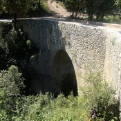
Pont romain de Lurs (5 km)
« pont de la Mort de l'Homme »
Bourne de Tavernoure (9 km)
Bourne de Tavernoure, possible Roman boundary marker