
Vici.org
Il n'y a pas d'images. Télécharger une image.

Les environs:

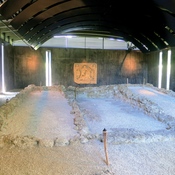
Mithraeum Königsbrunn

Localisation:

  • Allemagne, Oberottmarshausen
  • geo:48.230682,10.861181
  • Précision ± 0-5 m.

Classification:

  • Voie romaine
  • Visible

Identificateurs:

  • vici:place=26575

Annotations

A seven km segment of this road is visible between Königsbrunn and Untermeitingen.   Built  41-54 AD


See: http://www.lechrain-geschichte.de/VKW_VCAugusta_hist_Landschaftsspuren.html


À proximité

Roman Settlement (1 km)

Roman Settlement

Battle of Lechfeld (955) (3 km)

The Battle of Lechfeld was a series of military engagements over the course of three days from 10–12 August 955 in which the German forces of King Otto I the Great annihilated a Hungarian army led by harka Bulcsú.

Milestone Königsbrunn (CIL 17-04-01, no. 006) (4 km)

Milestone Königsbrunn (CIL 17-04-01, no. 006), see http://oracle-vm.ku-eichstaett.de:8888/epigr/epieinzel_en?p_belegstelle=CIL+17-04-01,+00006. Data from http://francia.ahlfeldt.se/