Vici.org
Keine Bilder von diesem Ort. Bitte, Bilder hochladen.

Umgebung:

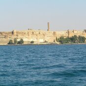
Qalaat Jaabar

Lage:

  • Syrien, Ḩurayjat Jaḩsh
  • geo:35.903545,38.384197
  • Lage ± 0-5 m.

Period or year:

  • -1400~ / -1200~

Klassification:

  • Kastell
  • Sichtbar

Identifiers:

  • vici:place=23298

Anmerkungen

Es gibt noch keine deutschsprachige Anmerkungen. Präsentiert wirden Anmerkungen auf English.

Tell Fray (T 532) was a Late Bronze Age town, dates to the XIV century BC and was destroyed by the fire in XIII cent, BC. The site is identified with ancient Yakharisha {Jahariååa or Iaharisa). Nowadays beneath the waters of Lake Assad.

Sources:

  1. Adnan Bounni: "Découvertes archéologiques récentes en Syrie", Comptes-rendus des séances de l'année - Académie des inscriptions et belles-lettres (in French), 132 (2): 1988, pp. 361–380
  2. Tony J. Wilkinson,  On the margin of the Euphrates. Settlement and land use at Tell es-Sweyhat and in the upper Lake Assad region, Oriental Institute Publications, vol. 124, Chicago: Oriental Institute, 2004 https://oi.uchicago.edu/sites/oi.uchicago.edu/files/uploads/shared/docs/OIP124.pdf

In der Nähe

Tell Abu Hureyra (4 km)

Remains of the Epipaleolithic and Neolithic settlements .

Qalaat Jaabar (8 km)

Qalaat Jaabar

Athis (18 km)

OmnesViae import TPPlace2596