
Vici.org

Omgeving:

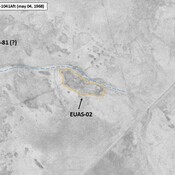
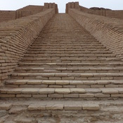
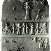
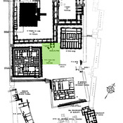
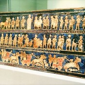
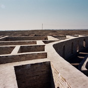
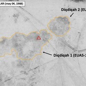
EUAS-72_Anonymous settlement_Map site_Wright (1966), in ADAMS (1981), p. 337 (fig 26)IRAQ_Lower Euphrates_1968_AS (EUAS-02)ZigguratUr-Nammu StelaUr, planUr, E-dublal-mahUr, E-giparE-hursagUr, zigguratUr, So-called IRAQ_Lower Euphrates_1968_Diqdiqah (EUAS-11 & 12)

Locatie:

  • Irak, ‘Abd Āl Washīḩ
  • geo:30.971029,46.031044
  • Locatie precies

Period or year:

  • -5800~ / -2050~

Classificatie:

  • Stad
  • Zichtbaar

Identifiers:

  • vici:place=20964

Annotaties

Er zijn nog geen Nederlandstalige annotaties. Hier volgen annotaties in het Engels.

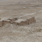
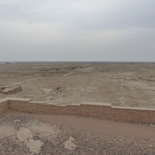
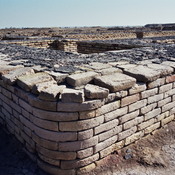
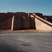
Settlement dates to ca. 5800 to 2050 BC. It gave the name to the period. This term was coined at a conference in Baghdad in 1930.

See:

  1. Harry R. Hall et  C. Leonard Woolley, Ur Excavations, vol. I (Al-‘Ubaid), Oxford 1927
  2. Pinhas Delougaz, "A Short Investigation of the Temple at Al-‘Ubaid", Iraq 3 (1938), pp. 1-11.
  3. https://www.cemml.colostate.edu/cultural/09476/iraq05-073.html
  4. Jean Louis Huot, hasło Ubaid, w: Eric M. Meyers (wyd.), The Oxford Encyclopedia of Archaeology in the Near East, vol. V, Oxford University Press, New York - Oxford 1997, pp.. 251-252.
  5. Appendix, The Southern Margins of Sumer – Archaeological Survey of the Area of Eridu and Ur, Henry T. Wright, 1966, in ADAMS R. McC. (1981), Heartland of Cities. Surveys of Ancient Settlement and Land Use on the Central Floodplain of the Euphrates, University of Chicago Press ( https://archive.org/details/heartlandofcitie0000adam/page/n5/mode/2up )

  6. WIKIPEDIA, Tell al-Ubaid (https://fr.wikipedia.org/wiki/Tell_al-Ubaid)

Settlement dates to ca. 5800 to 2050 BC. It gave the name to the period. This term was coined at a conference in Baghdad in 1930.

See:

  1. Harry R. Hall et  C. Leonard Woolley, Ur Excavations, vol. I (Al-‘Ubaid), Oxford 1927
  2. Pinhas Delougaz, "A Short Investigation of the Temple at Al-‘Ubaid", Iraq 3 (1938), pp. 1-11.
  3. https://www.cemml.colostate.edu/cultural/09476/iraq05-073.html
  4. Jean Louis Huot, hasło Ubaid, w: Eric M. Meyers (wyd.), The Oxford Encyclopedia of Archaeology in the Near East, vol. V, Oxford University Press, New York - Oxford 1997, pp.. 251-252.
  5. Appendix, The Southern Margins of Sumer – Archaeological Survey of the Area of Eridu and Ur, Henry T. Wright, 1966, in ADAMS R. McC. (1981), Heartland of Cities. Surveys of Ancient Settlement and Land Use on the Central Floodplain of the Euphrates, University of Chicago Press ( https://archive.org/details/heartlandofcitie0000adam/page/n5/mode/2up )

  6. WIKIPEDIA, Tell al-Ubaid (https://fr.wikipedia.org/wiki/Tell_al-Ubaid)

In de buurt

Tall al-Ubajd [Ubaid]

Necropolis of Ubaid

Anonymous site (EUAS-74) (1 km)

Very small mound, visible on Corona imagery (1968), since destroyed by cultivation. Bricks and green glazed sherd collected by T. Wright (1966), though undated.


Dit object is toegevoegd door Elżbieta op 2015-07-03. Laatst bewerkt door Julien De Chocqueuse op 2026-09-06. Persistent URI: http://vici.org/vici/20964 . Download als RDF/XML, KML.
Annotatie beschikbaar onder de Creative Commons Naamsvermelding-GelijkDelen 3.0 Unported-licentie. Metadata beschikbaar onder de Creative Commons Publiek Domein Verklaring, tenzij expliciet anders aangegeven.

Vici.org partners:

Livius.org: articles on ancient history   Rijksmuseum van Oudheden