Er zijn nog geen Nederlandstalige annotaties. Hier volgen annotaties in het Engels.
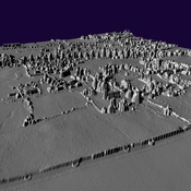
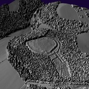
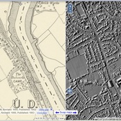
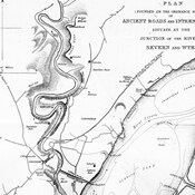
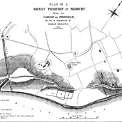
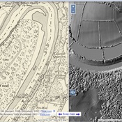
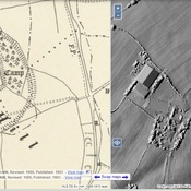
Royal Commission aerial reconnaissance on 22nd July 2013 discovered cropmarks of a Roman marching camp situated on a low ridge at Killcrow Hill, c.2.7km east of Caerwent Roman town. The camp measures 113m SW/NE by 87m NW/SE and encloses 0.98ha. making it the smallest camp in Wales and the Marches with an approximate holding capacity of 500 to 700 men. It has well defined simple gateways on the north side (7m wide) and west side (6m wide) but entrance gaps, if they exist, on the south and east sides are obscured by a lack of clarity in the cropmark and by darker patches of deeper soil on the east side.
It probably dates to the earliest Roman campaigns in the region, between AD 48 and AD 60/61, of which some of the earliest in south-east Wales against the Silures tribe date to AD 49-501.
See also
Bronverwijzingen
- ↑Coflein: Killcrow Hill Roman Marching Camp
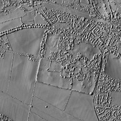