
There is no English annotation yet. Presented is an annotation in Dutch.
Watling Street (West). Zie M.C. Bishop: The Secret History of the Roman Roads of Britain


Watling Street (West). Zie M.C. Bishop: The Secret History of the Roman Roads of Britain
Watling Street (West). Zie M.C. Bishop: The Secret History of the Roman Roads of Britain
IA Settlement.
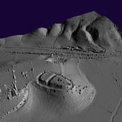
Iron Age Settlement
Iron Age Settlement