

Er zijn nog geen Nederlandstalige annotaties. Hier volgen annotaties in het Engels.
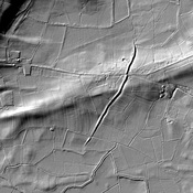
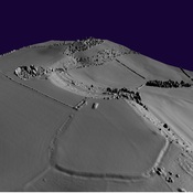
The Fosse Way was one of the major Roman Roads in Britain, running from the coast near Seaton to Lincoln (Lindum)
This segment from Ilchester to Bath is shown in Margary as Road 5B.