There is no English annotation yet. Presented is an annotation in Dutch.
Seleucid (?) rock relief


Seleucid (?) rock relief
Seleucid (?) rock relief
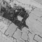
Probable settlement. Located with satellite imagery.
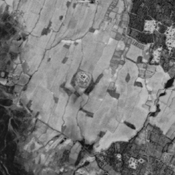
Probable settlement (ancient Kir?). Located with satellite imagery.
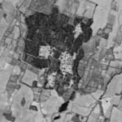
Probable settlement. Located with satellite imagery.