

Il n'y a pas une annotation en français. Présenté est une annotation en Anglais.
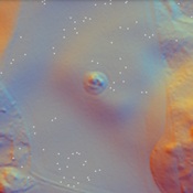
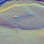
This is one of the so called “Glen Blocker Forts” built circa 85. They were used only briefly before being abandoned and were located so as to control the exits from the Glens which were defiles or valleys leading out of the highlands. TThese forts are now considered to be a part of the Gask Ridge system of border control and they include Drumquhassle, Malling, Bochastle, Dalginross, Fendoch, Inchtuthil, and Inverquharity.
http://canmore.rcahms.gov.uk/en/site/33713/details/inverquharity/